Williston Forge Wall Map Of Netherlands / Holland With Regional Boundaries
Colourblue,gray,green
Size
Any Size
120.0 H x 100.0 W x 3.0 D cm
125.0 H x 105.0 W x 3.0 D cm
1 Stores
First seen in Jul 2022
Description
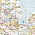
A highly detailed route-planning map of the Netherlands from Falkplan. Includes an index of place names on the reverse. A different level of mapping base is used for the Netherlands and the surrounding countries, to further emphasize the political boundaries. Also included is an inset of the main through routes, including motorway exits with number and name. Coloured relief is used for natural areas like sand dunes and woods. Road distances are also included. Format: Unframed Paper, Size: 120cm H x 100cm W
You may also like


loading
Discover more