Description
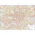
This wall art is a central London street wall map. Enhanced street map of a large area of central London. Street-level detail covering the area from Hammersmith in the West to Greenwich and the Isle of Dogs in the East, from Islington and Stoke Newington in the North to Wandsworth and Brixton in the South. Central London map contains details of London boroughs and postcode areas, as well as points of interest in the London streets. Wall map of Central London with street-level detail is ideal for the workplace. The map shows London Underground stations and the congestion charge zone. This is a useful map for planning out transport routes and journeys in London, as it contains railway lines, road and street-level detail. This huge central London street wall map (laminated) with encapsulation gives the map a write-on, wipe off finish. Using a dry wipe marker, any writing on the map can be wiped off with a proprietary cleaner. Size: 84.1cm H x 118.9cm W x 0.5cm D
You may also like


loading
Discover more